Underprepared in Waterton Canyon: Birding Colorado Railroad History Along the High Line Canal
As I approached the trailhead in the low morning light, I could hear rustling in the deeply shadowed, weedy margins of the fenceline. Reaching for my glasses case to swap out my sunglasses, I realized I had made the tactical error of leaving them in my pack, in the car. I guess I would be missing out on these Spotted Towhees, or White-crowned or Song Sparrows. Whatever they were, I wished my shades and other gear were with me, instead of on the other side of the busy road.
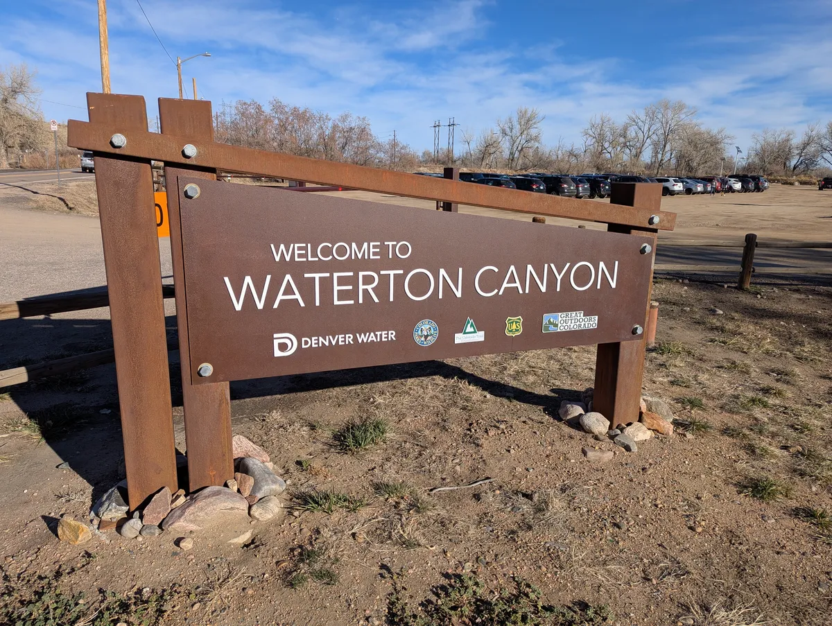
As I had pulled into the potholed Denver Water parking lot near the trailhead for Waterton Canyon shortly after sunrise in early December, I was still blissfully unaware of all of the particular ways I had underprepared for this outing. This chronic underpreparedness is something that's settled into me lately. I don't know how much of it is working largely from home away from other people, the natural effects of aging, or something else, but it's something I would like to mitigate.
Despite my early arrival, the parking lot was already fairly full. This was not unexpected - Waterton Canyon, besides being the official start of the High Line Canal trail is also the first leg of the Colorado Trail (heading the other way). It's easily accessible, and given that the first six miles or so of the trail up the canyon is actually the Denver Water service road, it's very popular with day hikers, runners, and other outdoor recreation enthusiasts in the area.
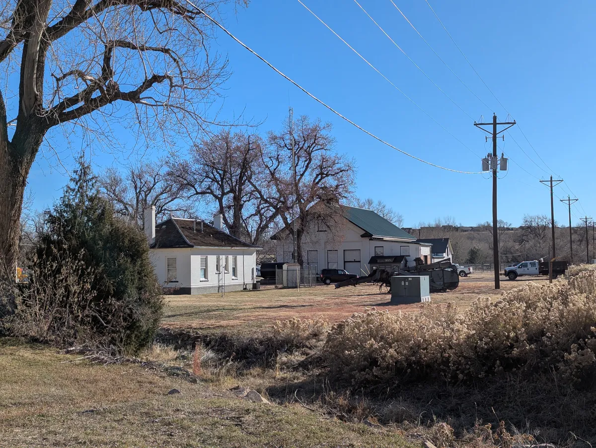
As I started my walk, I paused to inspect the fenceline again near a wayside stop explaining Kassler, the small compound of whitewashed buildings behind the barbed-wire fence here. Kassler (originally Platte Cañon Filtration Plant) was the site of the first slow sand filter west of the Mississippi, completed in 1902. If you have one minute and twenty-nine seconds, this video on the American Water College YouTube channel explains very quickly how it works. If you don't have that much time just know that it's named very descriptively. More importantly, unless you're already a water engineer you'll learn the term "schmutzdecke," the meaning of which is also pretty much right there on the tin. Anyway, the plant was begun after the city grew up around the existing water supply pumps located near present-day Confluence Park in downtown Denver, polluting the source, and ran for decades, finally closing in the 1980s when it could no longer keep up with demand.
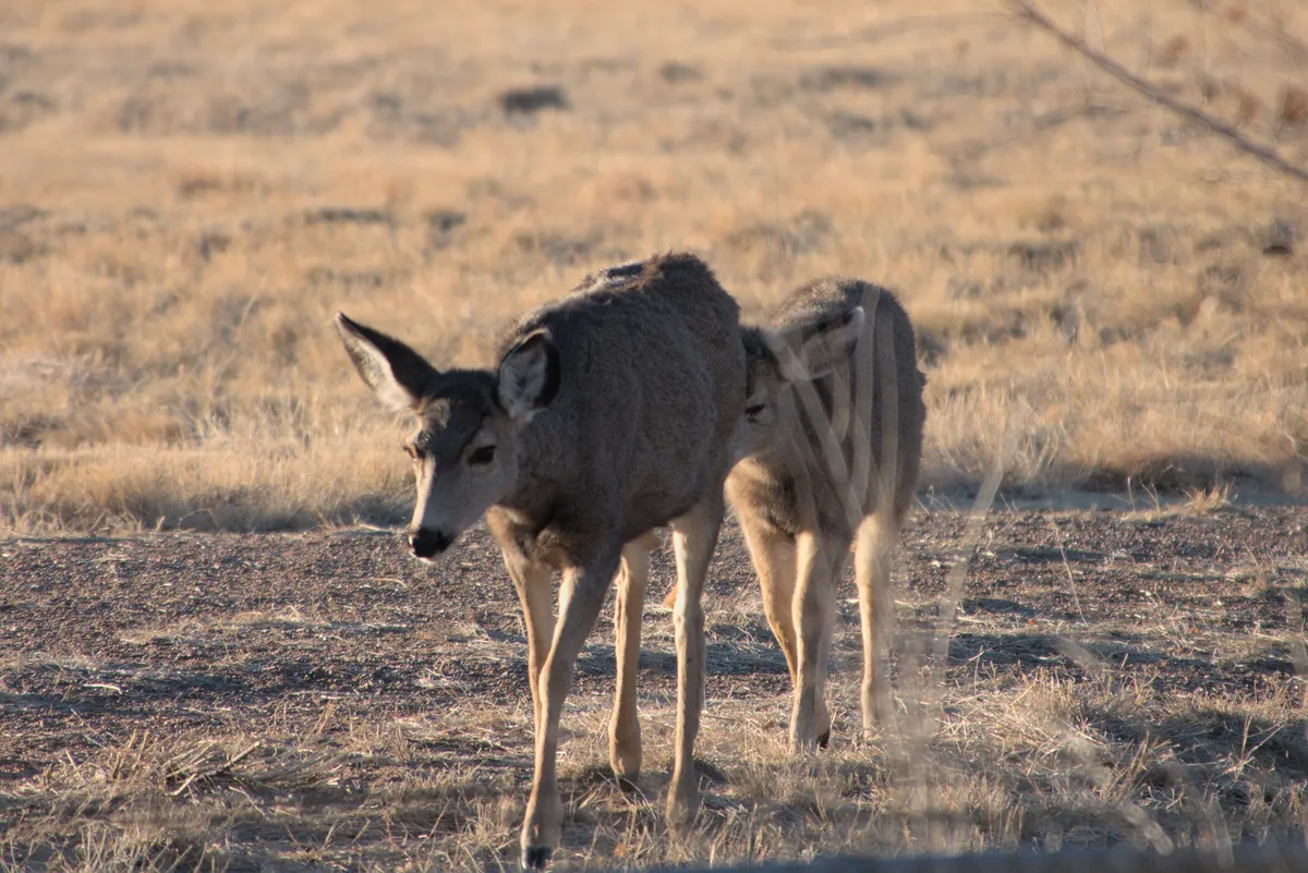
There was a sparrow of some sort in the dead brush overhanging the fence, but I didn't get a very good glimpse, mostly due to its speed though the sunglasses were a contributing factor. Nothing much else to see here so I moved up 100 yards or so to the Mule Deer Rest Stop. Aptly named this morning as a small herd was directly across the road, grazing on the Kassler compound. I tried to get a picture and kept moving.
Maybe a quarter mile farther along I heard my first real birds of the day vocalizing. Definitely Black-capped Chickadees. As I approached I found there to be a flock of six foraging in the dormant brush along the ridge on the right side of the road. While I observed and photographed, two Spotted Towhees joined them below the bushes: A perfect Colorado winter birding tableau.

As I approached the opening of the gorge, I noticed two wayside signs off to the right in a grassy, park-like area. Strolling over to inspect them, a Blue Jay began making concerted Red-tailed Hawk noises. At least I assumed it was a Blue Jay. My hunch was soon confirmed when it became visible a few minutes later in the top of a tree. I briefly reflected on how when I first started birding in earnest almost 10 years ago, I would have marked this as a hawk and moved on. But I've learned since then, and honed my understanding of habitat enough that now I (mostly) know better.
One of the wayside exhibits in this park concerned the Denver, South Park and Pacific Railroad, a narrow-gauge railroad which was constructed through here in 1878. The railroad was created by a group of investors led by territorial governor John Evans, and meant to reach the gold fields in South Park and beyond all the way to the mining centers of the San Juan mountains, with the ultimate intention to make it even farther to California, hence the name. The history is fascinating: Denver at this time was jockeying for designation as territorial (and later, state) capital with the likes Golden, (Old) Colorado City, and Colorado Springs, and securing such a railroad line was a high priority to make the city more competitive. Long story short, Denver won, and Denver, South Park and Pacific was part of that.
The railroad was begun in 1874. It came west along Bear Creek, roughly following the route of today's Hampden Boulevard, from Sheridan Junction to Jefferson (which was later renamed Morrison). In fact, in my old stomping grounds at Stone House Park in Lakewood, there is a small, unassuming plaque dedicated to the railroad. The intent at the outset was to stop at the quarry at George Morrison's, and possibly continue on up Bear Creek or Turkey Creek to South Park. Even before any rail was laid though, surveys had demonstrated the impracticalities of those routes, and the canyon of the South Platte had already been identified as providing the penetration of the foothills that would be necessary to create a successful line. And so as the rail was laid a spur left Bear Creek Junction and headed southwest to present-day Waterton and the mouth of the canyon, and eventually beyond.
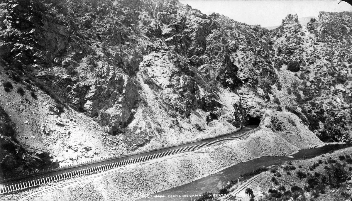 (This 1880s photograph by William Henry Jackson shows the wood-frame High Line Canal viaduct in the South Platte Canyon gorge. The overhead pipes today exit just to the left of the tunnel entrance shown here. Today's trail now exists where the railroad bed is visible in the lower right of the photo. Denver Public Library Special Collections, WHJ-410)
After 1890 the railroad also served to some extent as a tourist line, serving small whistle stop communities and resorts such as Buffalo Creek, Pine Grove, and Strontia Springs (Deansbury) along the Platte, where people made short getaways to fish, enjoy hot springs, and relax in the mountain atmosphere - just as tourists do today. One 1925 Union Pacific tourist publication notes 26 resorts located between Denver and Grant - a distance of only 66 miles. The road you hike through this gorge largely follows the old railroad bed. The tracks were ripped up in the late 1930s. The area was later designated a National Historic District on the National Register of Historic Places, and you can still visit buildings such as the South Platte Hotel and Green Mercantile Store in Buffalo Creek.
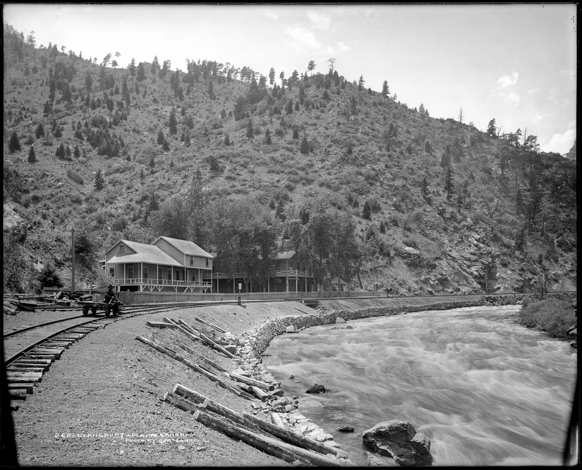 (This Louis Charles McClure photograph from the early 20th century shows Deansbury/Strontia Springs, a typical resort in the Platte Canyon at that time. Denver Public Library Special Collections, MCC-262)
By this point in my hike the trail was rapidly approaching the gorge proper, and with it on this winter morning came a steady and cold wind. In other words: not the best birding weather. The wind was enough to limit hearing any distant bird sounds, and also enough to keep most bird activity down, limiting opportunities to see them. But still I made my way, scanning the river occasionally for possible waterfowl, as well as a much hoped-for American Dipper. When not looking at the water, I was looking upslope at every juniper, trying to detect an expected Townsend's Solitaire. But there just wasn't any activity. I did spot a few Common Ravens soaring high above, but by the time I reached the overhead pipes that carry water from a little farther upstream to Marston Reservoir, my list tally was only eight species.
Starting a new list to carry me from the pipes to my ultimate goal, the High Line Canal Diversion dam, I headed back into the wind. Not far up the trail I stopped at a small platform overlooking the river that contained a plaque memorializing Glenn Gilbert Saunders, a former Denver City Attorney and key player in securing Denver water rights, according to the text. Finishing my reading, I noted the Song Sparrows and towhees in the scrub along the trail, and quickly headed for the gooseneck in the canyon.
At this big bend, the sun was finally high enough to make some headway down the walls of the canyon to the trail proper. Making the turn, the wind suddenly was no longer a factor. I was studying the metamorphic rocks that are so apparent at this point in the hike when I heard it - the familiar buzzy call of a Canyon Wren. It was just one call at first, but very soon came a confirming call, and then another, and another. I arrived this morning with Canyon Wren as another top target, as it's not a likely candidate for anywhere else the canal will take me. On my way back though, my underpreparedness would come back to haunt me, as the bird had made its way within 5-10 feet of the trail, perhaps the best opportunity I have ever had for a good picture of a Canyon Wren - but I found my camera battery completely drained as I hit the button to take the photo. No matter - the two Canyon Wrens I logged on this trip lifted my spirits.
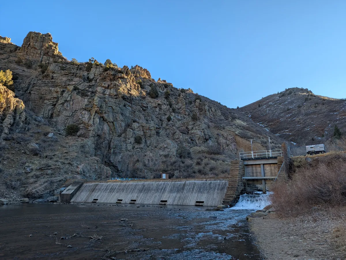
Just around the other side of the bend I finally arrived at Black Bear Rest Area, which overlooks the historic High Line Canal Diversion Dam, first constructed in 1884, and reconstructed in 2016 after high runoff in 2015 damaged the dam. This is the literal beginning of the canal, where it takes its water from the South Platte and delivers it downstream to all of the High Line irrigation customers - at least when conditions are right, which is not as common as one might hope if you're a farmer, which itself has basically been the story from the beginning.
While I admired the dam, I finally heard my first (and only) Townsend's Solitaire of the day. By this point, I was worried the wind had stolen my opportunity to spot one, but here one was perched in the top of a tree and calling its distinctive note. Glad to have spotted one at the farthest point of my hike, I began to make my way back down the canyon.
For this leg, I redoubled my efforts at paying attention to each riffle I passed. At least one American Dipper had to be in the Platte here somewhere. Unfortunately, none showed - though I did note a lot of sign on the rocks. It just may not have been cold enough to push any down this morning. Not the first time - and surely not the last time - I will "dip" on dipper.
As I completed my lists for the day back in the parking lot, I noted one other big miss for the day: Woodhouse's Scrub Jay. Another common local denizen of the scrubby foothills, it's unclear to me how likely it will be to encounter one farther down the High Line. Corvids are a favorite of many birders and non-birders and I'm no different, so I would have like to have spotted one.
All told, I ended the day at 17 species across my three lists. Not the most outstanding birding outing, but given the conditions, I will take it. I'm really looking forward to building on that number with winter waterfowl in upcoming segments.
Sources and Further Exploration
Besides those linked in the text itself, I found a number of other sources useful in digging into the past at Waterton, and even more for delving into other aspects of the area.
For Denver/Colorado water history, the best source I've found so far is Patty Limerick's A Ditch in Time: The City, The West, and Water (Library), a highly-readable account of the development of water resources for Denver. Its first chapter builds a coherent narrative out of the tangled history of the early efforts at developing drinking water for the city of Denver, with its numerous companies and projects vying for dominance.
For history of the Denver, South Park, and Pacific, I found among a plethora of resources housed in the Denver Public Library Special Collections and Archives The South Park Line: A Concise History (Library) (Colorado Rail Annual No. 12) edited by Gordon Chappell, Robert W. Richardson, and Cornelius W. Hauck and published by the Colorado Railroad Museum to be just what I needed to orient myself. The US Forest Service has also made digitally available a map/brochure that shows at a glance the extent of the line between Denver and Gunnison, including spur lines. Other maps are also available at Denver Public Library Special Collections and Archives. For railfans, two locomotives used by the Denver, South Park, and Pacific (and the two later companies operating the lines: Denver, Leadville and Gunnison and the Colorado and Southern) still exist. Locomotive #191 is on display at the Colorado Railroad Museum in Golden, and is the oldest steam locomotive in Colorado. Locomotive #9 is on view at the Highline Railroad Park in Breckenridge, Colorado.
The National Register Inventory for the North Fork Historic District, as well as additional documentation for the district are helpful in visualizing its extent.
And of course, a local favorite The Thunder Tree: Lessons from an Urban Wildland (Library) by Robert Michael Pyle has inspired this project and is highly recommended to anyone interested in a glimpse of Denver and the High Line before decades more development fully enveloped it.
Find the full post index on the home page.
If you enjoyed this post, please consider making a donation to the High Line Canal Conservancy.
Follow along on Instagram and receive monthly updates via email.